test Menu 1
test Menu 1
test Menu 2
test Menu 2
test Menu 3
test Menu 3
test Menu 4
test Menu 4
test Menu 5
test Menu 5
test Menu 7
test Menu 7
test Menu 8
test Menu 8
Test menu 9
Test menu 9
Test menu 10
Test menu 10
KOA HOME
KOA HOME
Culture & Heritage Home
Culture & Heritage Home
Organization
Organization
Programs
Programs
Pay Membership Dues
Pay Membership Dues
Donate Online
Donate Online
History
History
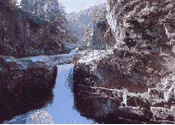
Geography
Geography
Ethnic Groups
Ethnic Groups
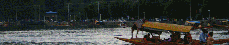
Tourism
Tourism
Kashmiri Music
Kashmiri Music
Language
Language
Cuisine
Cuisine
Satisar Foundation
Satisar Foundation
Virtual Homeland
Virtual Homeland
IILS
IILS
NSKRI
NSKRI
Project Zaan
Project Zaan
Vyeth Television
Vyeth Television
Writers & Columnists
Writers & Columnists
Book Reviews
Book Reviews
Memoirs
Memoirs
Tributes
Tributes
CULTURE Page
CULTURE Page
Region
Region

Organizations
Organizations
Artistes
Artistes
Playwrights
Playwrights
Poets
Poets
Paintings
Paintings
Personalities
Personalities
Leaders
Leaders
Names
Names
Proverbs
Proverbs
Writeups
Writeups
Short Stories
Short Stories
Folktales
Folktales
Crown of India
Crown of India
Glimpses of Culture
Glimpses of Culture
RELIGION Page
RELIGION Page
Rituals & Ceremonies
Rituals & Ceremonies
Places of Worship
Places of Worship
Hindu Deities
Hindu Deities
Saints & Sages
Saints & Sages
Devotional Songs
Devotional Songs
Hindu Scriptures
Hindu Scriptures
Nilmata Purana
Nilmata Purana
Panchastavi
Panchastavi
Shaivism
Shaivism
Kundalini
Kundalini
IAKF
IAKF
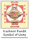
Panun Kashmir
Panun Kashmir
HISTORY Page
HISTORY Page
POLITICS Page
POLITICS Page
Organizations
Organizations
Appeal
Appeal
Islamic Fundamentalism
Islamic Fundamentalism
Atrocities in Kashmir
Atrocities in Kashmir
Pakistan's Role
Pakistan's Role
Afghanistan Factor
Afghanistan Factor
Historical Documents
Historical Documents
Kargil Heroes
Kargil Heroes
Video Clips
Video Clips
Slide Presentations
Slide Presentations
Articles/Opinions
Articles/Opinions
PERIODICALS Page
PERIODICALS Page
PUBLICATIONS Page
PUBLICATIONS Page
Downloads
Downloads
Kashmir Sentinel
Kashmir Sentinel
Koshur Samachar
Koshur Samachar
Unmesh
Unmesh
Vitasta
Vitasta
Har-Van
Har-Van
Patrika
Patrika
Milchar
Milchar
Voice of J&K
Voice of J&K
Neel Nag
Neel Nag
Panchtarni
Panchtarni
Paannyaar
Paannyaar
Vaakh
Vaakh
Image Gallery
Image Gallery
Social Media
Social Media
Matrimonials
Matrimonials
Copyrights Policy
Copyrights Policy
Disclaimer
Disclaimer
Privacy Statement
Privacy Statement
Credits
Credits
Contact Us
Contact Us